What is Point Cloud to CAD Model? A Beginner’s Guide for Architects & Engineers
Renovations, retrofits, or even documenting historic structures all have one thing in common: they start with assessing what is already built. That’s where Point Cloud to CAD Modeling comes in. In the present day and age, AEC professionals and project stakeholders are not interested in following the manual ways of building surveying. Point cloud cad is a process that has emerged as one of the most dependable resources for engineers and architects, particularly in renovation and facilities management projects, in which accuracy is critical.
In this article, we’ll explain what autocad point cloud means, why it matters, and how it fits into your regular design and construction processes.
Starting From the Ground Up: What’s a Point Cloud Anyway?
Imagine entering a building that is a century old and attempting to use a tape measure to record every detail of the ceiling, columns, and doorways. Weeks would pass, and you would most likely still miss something. Alternatively, the building can be scanned in a matter of minutes using laser scanners or photogrammetry tools, which can record millions of measurement points in three dimensions.
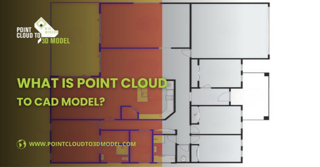
The result? A point cloud, essentially a digital swarm of dots that collectively represent the building’s geometry. Each point has X, Y, and Z coordinates, sometimes with color or intensity values. Here’s the catch: while point clouds are rich with detail, they’re not very “design-friendly.” You can’t just drop a point cloud into AutoCAD and start drafting walls. That’s why conversion into CAD models is so important.
What Does the Point Cloud to CAD Model Mean?
So, what does “point cloud to CAD model” actually involve? In simple terms, it’s about transforming that massive collection of points into usable and editable architectural and engineering designs. This includes the location and dimensions of design elements in a building. For example:
- A cluster of laser scan points that defines a vertical plane becomes a wall.
- A horizontal surface defined by thousands of dots becomes a floor slab.
- Pipes and conduits traced from the cloud become accurate MEP elements.
This isn’t a one-click process. It requires skilled CAD or BIM technicians that interpret the point cloud data, trace geometry, and develop editable CAD models. They do it manually to ensure accuracy. The final result is a clean AutoCAD drawing with defined layers or 3D models that architects and engineers can immediately use.
Why Point Cloud to CAD Model Matters for Architects?
You may be wondering, “Why can’t I just design straight from the point cloud?” at this point. The short answer is that point clouds are too large and unstructured for daily workflows, even though they are accurate. Point cloud to cad model entails using the as-built data to create precise floor plans, elevations, and sections for architects. It entails confirming current conditions, identifying conflicts with new designs, and preventing expensive surprises on the job site for engineers.
There are several reasons why architects prefer using point cloud CAD models. Some of them include:
- Editable: As the design develops, you can change the design, add layers and include design elements
- Lightweight: Point cloud cad models are easy to open on computer system and shareable with project stakeholders
- Compatible: Autocad point cloud drawings developed from point cloud data operates on a variety of software platforms, including AutoDesk AutoCAD
Typical Workflow: How the Process Unfolds
Point cloud to CAD modeling isn’t just about technology, it is a structured process that guides architects and engineers from raw scanned data to editable design documentation. Here’s a closer look at how it usually unfolds:
1. Data Capture
The procedure starts on location, where the current conditions are recorded using a drone photogrammetry system or 3D laser scanner. The scanner captures millions of data points in a matter of minutes rather than measuring a single room at a time. This step is essential for architects because it gives them a comprehensive digital “snapshot” of the building, complete with irregular geometries, hidden angles, and features that may have been overlooked in earlier drawings.
2. Export and Pre-Processing
The raw scans are exported into standardized formats like LAS, RCP, or E57 after they are taken. This isn’t just a straightforward save-and-go step; technicians frequently clean and register the scans, aligning several scans to create a cohesive dataset. In architectural projects, noise, such as people moving or temporary obstacles, is eliminated at this stage to guarantee that the data accurately depicts the building’s structure.
3. Import into CAD
CAD software is then used to import the cleaned and registered point cloud. Architects may choose to work with AutoCAD, MicroStation, or Revit, depending on the project. The point cloud now serves as a digital reference background that directs the tracing procedure. Architects are instantly able to identify architectural features like windows, roof slopes, and walls.
4. Conversion into Geometry
This is where the real design preparation happens. CAD or BIM technicians carefully trace and interpret the point cloud to create accurate geometry in the autocad point cloud. In an architectural workflow, that means:
- Creating precise thicknesses and alignments for walls, windows, doors and partitions
- Modeling roofs, beams, and slabs to represent the current structural state of the building
- Representing circulation routes and stairways in accordance with usability standards and codes
5. Architectural Design Layering
Here’s where it becomes more design-oriented. Once the base geometry is modeled, architects begin to layer additional details onto the CAD drawings. This may include:
- Zoning out functional areas (residential, commercial, service spaces)
- Testing potential redesigns, such as shifting partitions or opening up circulation spaces
- Overlaying regulatory and code requirements directly onto the CAD model
- Running early space planning exercises using the accurate geometry as a foundation
Because the CAD output is dimensionally precise, architects can confidently make design decisions without the fear of overlooking site conditions.
6. Deliverables
Finally, the process concludes with structured deliverables. Depending on client needs, this could include:
- 2D CAD drawings (floor plans, sections, elevations) ready for design development
- 3D CAD models for spatial studies and visualizations
- Or even BIM-ready files, which architects and engineers can enhance further with materials, schedules, and cost data
At this point, the design team has not just a “drawing,” but a solid foundation for renovation planning, design development, and construction documentation.
The Practical Benefits You Can’t Ignore
So, why are more architects and engineers turning to point cloud CAD workflows? Because the benefits go far beyond just neat drawings.
- Accuracy without Guesswork: Outdated or insufficient records are used in many remodeling projects. Point cloud CAD models eliminate all possibility of guesswork by accurately capturing the actual as-built conditions.
- Time savings: Everything is recorded from the beginning, eliminating the need for frequent site visits to verify a missed measurement. Weeks later in the project, that initial investment saves money.
- Improved Cooperation: A common ground is a shared point cloud CAD model. By interpreting the same data, contractors, engineers, and architects can reduce misunderstandings.
- Decreased Risk: Rework, change orders, and expensive construction surprises are all decreased when there are fewer blind spots.
In the end, it changes renovation from a reactive process to one that is motivated by precision, clarity, and foresight.
Looking Ahead: Why This Workflow is Here to Stay
As the AEC industry depends more extensively on digital processes, Point Cloud to CAD modeling is becoming a necessity for renovation, retrofit and historical preservation projects. With construction projects becoming more complex and competitive, precision is the key for streamlines and error-free construction.
For architects, it means design decisions grounded in reality. For engineers, it is about anticipating structural surprises before they happen. And for project owners, it’s confidence that every dollar is spent wisely.
AEC firms are increasingly crossing borders to collaborate with specialized BIM companies for point cloud CAD conversion. The reason is simple: outsourcing lets them stay focused on their core business while reducing the time and cost involved in developing accurate CAD models from scan data. We support AEC and laser surveying companies worldwide, including the USA, UK, Germany, Italy, Greece and Australia by delivering precise point cloud to CAD model services.