The Process of Modelling from Point Cloud a Step-by-step guide
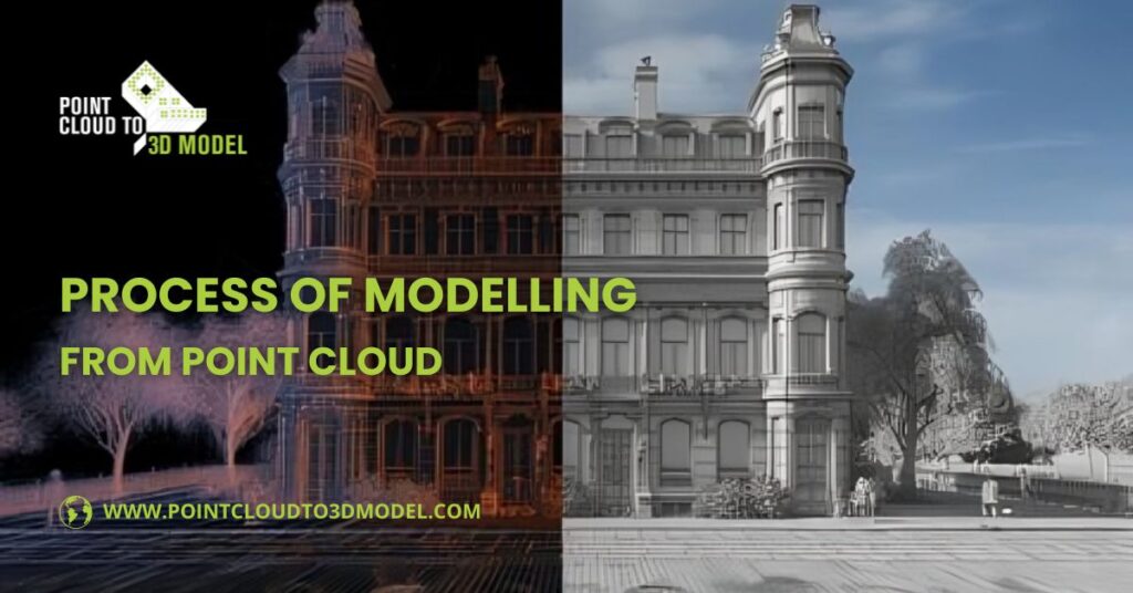
What is Point Cloud Modelling?
Let’s say there are millions and thousands of points everywhere and when they get colorised they look like a solid. These points are gathered by laser scanners, lidar camera mounted drones and many other machines. To define it properly Point Cloud Modelling takes the actual details of a site or building with 3D laser scanning technology. The result of this is a point cloud consisting of millions of discrete points that define the precise position of surfaces and objects in a 3D environment. This can be used to generate extremely accurate 2D drawings, 3D models, or even photorealistic images.
Common applications of Point cloud modelling
Point cloud modelling gets used in wide applications across industries. From Heritage conservation to infrastructure for road and bridge surveys, and in gaming or VR for realistic 3D environments.
- HBIM & Archaeology: Restoring historical sites like forts and documenting artifacts digitally.
- Video Game environment design: Creating realistic 3D environment and assets from real world scans.
- Virtual & augmented reality simulations: Useful for enabling immersive VR/AR experiences.
- AEC Sector: Useful for making a utility duplicates, modeling structures, and tracking project progress.
- Surveying & Mapping: For GIS Accurate measurement of terrains, roads, and infrastructure, maps for different uses.
- Facility management & disaster management: Planning maintenance, assessing damages, and supporting emergency responses.
Step-by-Step process of Point Cloud Modelling
1. Initial Survey Capturing the Point Cloud Data
First step begins with a full measured building survey, where 3D laser scanners capture every detail of the space.
2. Point Cloud Creation
The next step involves the process of captured data into specialized software. Example; In Recap Pro, create a new project, name it, and choose a save folder. Import point cloud by selecting a file, dragging and dropping. And then adjust scan settings like clipping intensity or coordinate system before processing. And this processed data ready to import into BIM software.
3. Modelling from Point Cloud Data
This processed point cloud is then imported into BIM authoring software, such as Revit for 3D BIM modelling. After importing into Revit, go to the Insert tab and click on Point Cloud, select the exported RCP file, and open it. Insert section line and along with 3D view to check placement, then adjust levels and move the point cloud to align with the floor. For drafting further, set the view range for a clean plan and start modelling.
4. 3D Model Verification & Quality check
The final step is once the model is created verify it against the original point cloud data which is a recap file and ensure whether the half inch accuracy is achieved. Further level of development can be done like information, such as materials, textures, and other details.
Best Practices for Processing Point Cloud Data?
For effective processing of point cloud data demands close planning and systematic procedures. To begin with, data needs to be organized and pre-processed through clearly naming files, logically grouping them into floor or zone, noise and unnecessary points removal, and ensuring uniform coordinate systems and units.
Then the scans should be precisely registered and aligned with target markers or cloud-to-cloud registration, and overlaps validated to keep misalignment to an absolute minimum. Ground control points are useful in maintaining accuracy in big projects.
Point cloud cleaning and filtering are also important. Sometimes walls appear doubled or extra surfaces show up in rooms; this usually happens because of glazing, mirrors, or water reflections that create extra points during scanning.
Anyone who works with point clouds daily will recognize these artifacts. Occasionally, corners or tight areas may not get captured fully, so marking extra points in such spots is necessary. Classification and labelling of points, like walls, floors, ceilings, and structural members, helps simplify modeling. For exporting, using formats like .las, .laz, .recap, or .e57 along with Matterport’s ensures smooth integration into Modelling workflows while preserving key information.
Also read: Revit Modeling Outsourcing for Scalable BIM Solutions
Which kind of software is used for Point Cloud modelling?
When working with point clouds, to make process smooth and accurate it’s essential to use correct software’s here’s the market domaining software’s follows:
- Autodesk Revit – Best software in the market for modelling point cloud
- Autodesk Recap Pro – Most widely used for importing, cleaning, and registering point cloud data, with seamless integration into Revit for BIM modelling.
- Autodesk Civil 3D/CAD – Used for Roadway and infrastructure projects, offering tools to generate surfaces and alignments directly from point clouds.
- Leica Cyclone – It provides processing, including registration, cleaning, and exporting to multiple formats.
- Trimble RealWorks – Particularly for scanning and modelling complex structures.
- Cloud Compare – Open-source software for visualization with very basic processing, and exploration of point clouds. It supports Python bindings.
These five tools highlighted are useful for point cloud processing, most of them are open source but yes, they are capable of handling substantial datasets efficiently.
Point Cloud to CAD Modelling Advantages
A 3D point cloud gives a very accurate digital record of a real object. It can replace the paper documentation, which are useful in engineering, architecture, virtual reality, gaming, and more.
- In construction, laser scanning has replaced traditional surveying because it captures precise building data that can be turned into 3D BIM or CAD models. This helps understand the site properly, check for structural issues like deterioration or deformation, make repairs more cost-effective, track project progress, and keep detailed records for future inspections.
- For civil projects, measuring roads is hard because of their size and safety risks. Laser scanning makes it possible to get accurate measurements quickly. The data can be compared with old records to find damage, improve road safety, and plan repair or replacement costs more accurately.
- Finally, let’s not forget the precision of data gathering at this stage is critical, and not finding utilities as they should be is an invite for rework and serious project delay. In engineering, especially reverse engineering, 3D scanning helps reproduce parts exactly, saving time and costs while giving reliable BIM models.
Conclusion
Point cloud modelling makes it easier to capture real-world details with high accuracy and their conversion to effective CAD or BIM models. It saves time, minimizes errors, and enables improved planning and monitoring of construction or civil projects.
Whether it’s an inspection of a building for structural faults or measuring roads, or making extra parts in engineering, point cloud modelling gives a perfect hand to resolve all this work with the proper software and correct workflows, the models are complete, accurate, and ready for use in real-world applications. Inconclusion, it closes the gap between measurement in the real world and digital creation, resulting in more efficient and accurate projects.