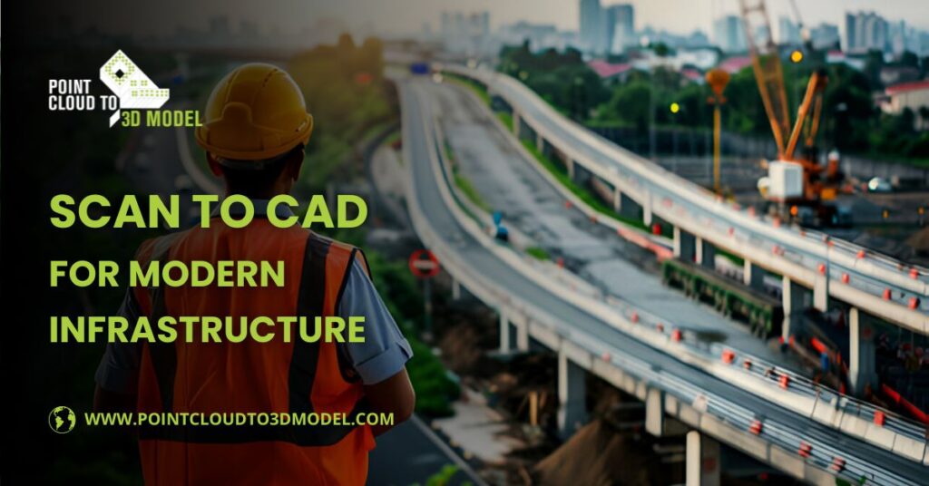
Scan to CAD for Modern Infrastructure Projects
In the ever-evolving landscape of engineering and construction, modern infrastructure projects demand precision, speed, and adaptability. While once effective, traditional surveying and drafting methods are now being outpaced by advanced technologies that offer faster and more accurate results.
One such technology is Scan to CAD for Modern Infrastructure—a transformative process redefining how infrastructure is planned, designed, and executed.
Scan to CAD is critical in modernizing workflows, reducing errors, and enhancing collaboration across teams, whether it’s a new highway, a bridge retrofit, or underground utility mapping.
What Is Scan to CAD?
Scan to CAD is a process that uses 3D laser scanning technology to capture the physical details of a real-world structure or environment. The result is a dense, high-accuracy point cloud representing every visible surface in that space. This point cloud data is then converted into detailed CAD models—either 2D plans or 3D models—that can be used for design, analysis, or renovation.
Scan to CAD for Modern Infrastructure becomes a powerful tool for large-scale public works and civil engineering projects. It enables stakeholders to visualize complex environments, analyze existing conditions, and design improvements without guesswork.
From city-wide utility systems to transportation corridors and water treatment plants, Scan to CAD delivers highly accurate, measurable data, forming sound engineering decisions.
The Importance of Scan to CAD in Infrastructure
Infrastructure projects are inherently complex. They involve a multitude of components—some visible and some hidden – spread across large geographic areas. Using conventional methods such as tape measurements, GPS, or total stations to capture existing conditions can take weeks, often resulting in incomplete or outdated information.
Scan to CAD for Modern Infrastructure addresses these challenges by providing real-time, data-rich insights. The benefits of having up-to-date, as-built models cannot be overstated. It allows for proactive planning, helps mitigate design conflicts, and ensures projects meet engineering standards from the outset.
In addition, infrastructure projects often intersect with existing systems, like utilities, buildings, or natural features, that must be preserved or modified carefully. Having an accurate CAD model derived from 3D scans helps teams work with existing constraints rather than being surprised by them later in the process.
Key Benefits of Scan to CAD for Modern Infrastructure
1. Improve Accuracy and Precision
One of Scan to CAD for Modern Infrastructure’s most significant advantages is its unmatched accuracy. Laser scanners can capture millions of data points per second, creating a complete and detailed digital site replica. This level of precision ensures that CAD models are accurate and incredibly reliable for engineering calculations, simulations, and construction planning.
For example, precise measurements are vital in a bridge rehabilitation project to ensure new components fit seamlessly with existing structures. Any inaccuracies could lead to costly redesigns, delays, or structural failures. Scan to CAD eliminates that uncertainty.
2. Time and Cost Efficiency
Traditional surveys are labor-intensive and often require repeat visits due to missed measurements or changes in site conditions. This inefficiency can significantly delay timelines and inflate project costs. Scan to CAD for Modern Infrastructure dramatically reduces these risks.
Laser scanning can be completed in a fraction of the time it takes to perform manual surveys. Once the data is captured, CAD models can be generated quickly and accurately. This streamlined workflow results in faster project initiation and execution, helping teams stay on budget and schedule.
3. Improved Collaboration and Communication
Infrastructure projects typically involve multiple teams—from engineers and architects to government agencies and contractors. Miscommunication among these stakeholders can lead to delays, budget overruns, or safety risks.
With Scan to CAD for Modern Infrastructure, everyone works from the same accurate and detailed digital models. These models become a single source of truth that improves transparency, streamlines approvals, and fosters better collaboration. Teams can identify issues earlier, coordinate design changes more effectively, and avoid costly on-site modifications.
4. Seamless Integration with BIM and GIS Platforms
Modern infrastructure relies heavily on Building Information Modeling (BIM) and Geographic Information Systems (GIS) for project planning and management. The great thing about Scan to CAD for Modern Infrastructure is that it integrates seamlessly with these platforms.
Point clouds can create BIM-compatible models, while CAD files can be geo-referenced for GIS use. This interoperability enhances the ability to plan infrastructure in a spatial context, aligning technical drawings with real-world locations.
5. Ideal for Renovation, Retrofit, and Maintenance Planning
Many infrastructure projects are not new buildings but upgrades or expansions of existing assets. Accurately understanding what already exists is crucial before any changes can be made. Scan to CAD provides comprehensive documentation of current conditions, enabling engineers to develop retrofit plans that align perfectly with the existing environment.
Whether upgrading a subway station, widening a road, or reinforcing a dam, Scan to CAD for Modern Infrastructure allows planners to create detailed renovation models that reduce uncertainty and support better outcomes.
Also read, Point Cloud to CAD for 3D Modeling: Benefits Across 3 Industries
Applications of Scan to CAD in Infrastructure Projects
- The applications of Scan to CAD for Modern Infrastructure span nearly every sector of civil engineering and urban development. Here are some everyday and impactful use cases:
1. Transportation Systems
Roadways, rail lines, and bridges benefit greatly from 3D scanning. Engineers can use CAD models to plan expansions, analyze traffic flow, or assess structural integrity. Tight clearances can be mapped with pinpoint accuracy for tunnels and overpasses, preventing conflicts with vehicle dimensions or future utilities.
2. Public Utilities and Energy
Utility providers use Scan to CAD to document substations, water pipelines, electrical grids, and gas networks. This is essential for maintenance, emergency repairs, and regulatory compliance. In renewable energy projects, such as wind farms or solar plants, Scan to CAD helps optimize layout and placement.
3. Urban Planning and Smart Cities
Municipalities use 3D scanning and CAD modeling to assess and upgrade stormwater systems, pedestrian walkways, public buildings, and underground networks. These models support innovative city initiatives, allowing for data-driven planning and resource optimization.
4. Airports, Ports, and Logistics Hubs
Ports and airports are expensive, complex facilities that require regular upgrades to meet capacity and security demands. Scan to CAD enables accurate mapping of runways, loading docks, terminals, and service roads, which supports expansion plans and operational improvements.
Scan to CAD Workflow in Infrastructure Projects
To successfully implement Scan to CAD for Modern Infrastructure, it’s essential to understand the typical workflow:
- Site Scanning: Technicians deploy terrestrial laser scanners or drone-mounted LiDAR systems to collect 3D data from the site. The scans are performed quickly with minimal disruption to the environment.
- Data Processing: The point cloud is cleaned, aligned, and registered into a complete model. Noise and irrelevant data are filtered out to prepare the dataset for CAD conversion.
- CAD Modeling: Using advanced software like AutoCAD, Revit, or Civil 3D, professionals convert the point cloud into usable 2D plans or 3D models. The model includes geometry, dimensions, and sometimes annotations.
- Quality Control: Accuracy checks are performed by comparing CAD dimensions to the raw scan data. Any inconsistencies are corrected to ensure the final model meets project requirements.
- Integration with Design Tools: The completed CAD models can now be used for planning, simulations, and construction documentation. They can be imported into BIM platforms or mapped onto GIS environments for broader analysis.
Choosing the Right Tools and Partners
Not all Scan to CAD services is created equal. You need providers with industry experience and access to advanced technology for infrastructure projects. Here are key factors to consider:
- Scanner Resolution & Range – High-end scanners are essential for large-scale infrastructure work.
- Data Processing Capabilities – Choose providers with the software tools and expertise to handle large datasets efficiently.
- CAD/BIM Expertise – Ensure the final output will integrate with your design ecosystem.
- Compliance and Standards – Work with professionals who follow local codes and industry standards for civil engineering.
The Future of Scan to CAD in Infrastructure
As cities grow and infrastructure ages, the need for fast, data-driven engineering solutions will only increase. The future of Scan to CAD for Modern Infrastructure includes:
- Drone-based LiDAR scanning for faster coverage of large sites.
- AI-powered modeling that automatically identifies features in point clouds.
- Cloud collaboration tools to share and update models in real-time.
These advancements will continue to improve project outcomes and make infrastructure development more sustainable, efficient, and responsive to community needs.
Conclusion
In an age where infrastructure must be built smarter, faster, and with fewer resources, Scan to CAD for Modern Infrastructure stands out as an essential technology. It provides the foundation for high-quality design, safer construction, and long-term asset management.
Whether you are an Engineer, Planner, Architect, or Government Agency, embracing Scan to CAD means unlocking a more accurate and efficient future for infrastructure development.